
The demand for charging stations is growing faster than ever. How do you maintain an overview? With EVTools, you can confidently navigate every step.

EVMaps provides insight into future charging demand, allowing you to lay the foundation today for tomorrow's mobility.
Comprehensive data and forecasts enhance decision-making for new charging site selection.
EVMaps helps clearly communicate policies and plans, and strengthen trust.
By visualizing the current charging infrastructure, planning network expansion becomes straightforward.
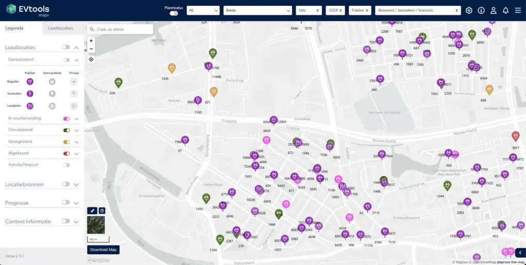
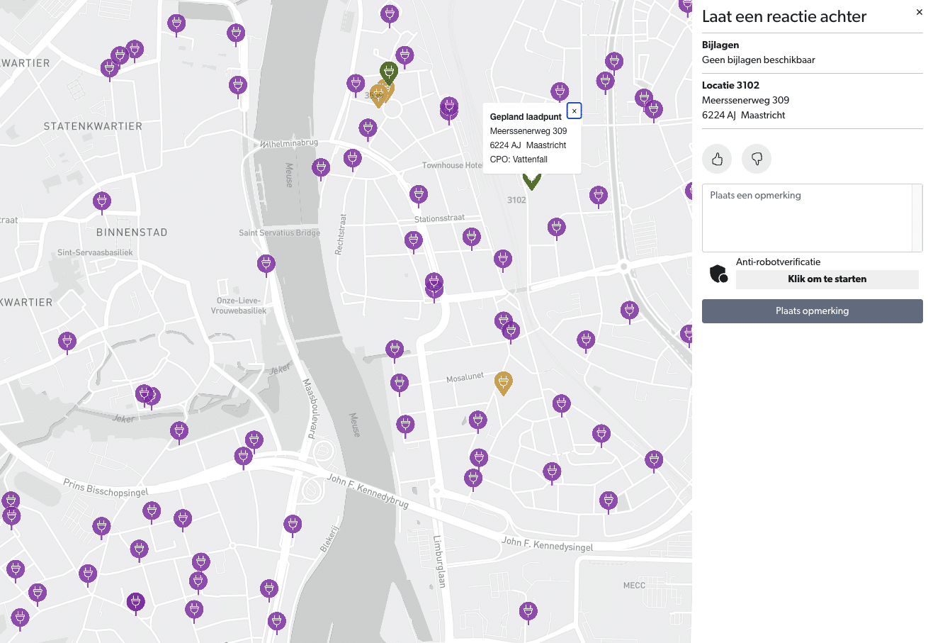
No more static network: see in real-time which locations are active, planned, or rejected, and maintain control over the rollout.
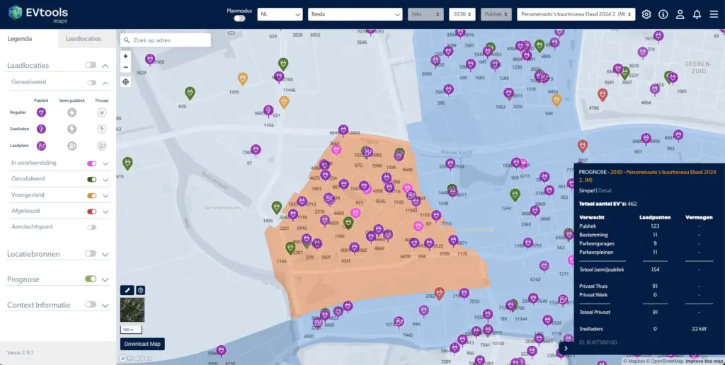
Stay one step ahead of growth. Predict where demand will increase, whether from residents, visitors, or freight traffic. This prevents ad-hoc decisions and allows for strategic forward planning.
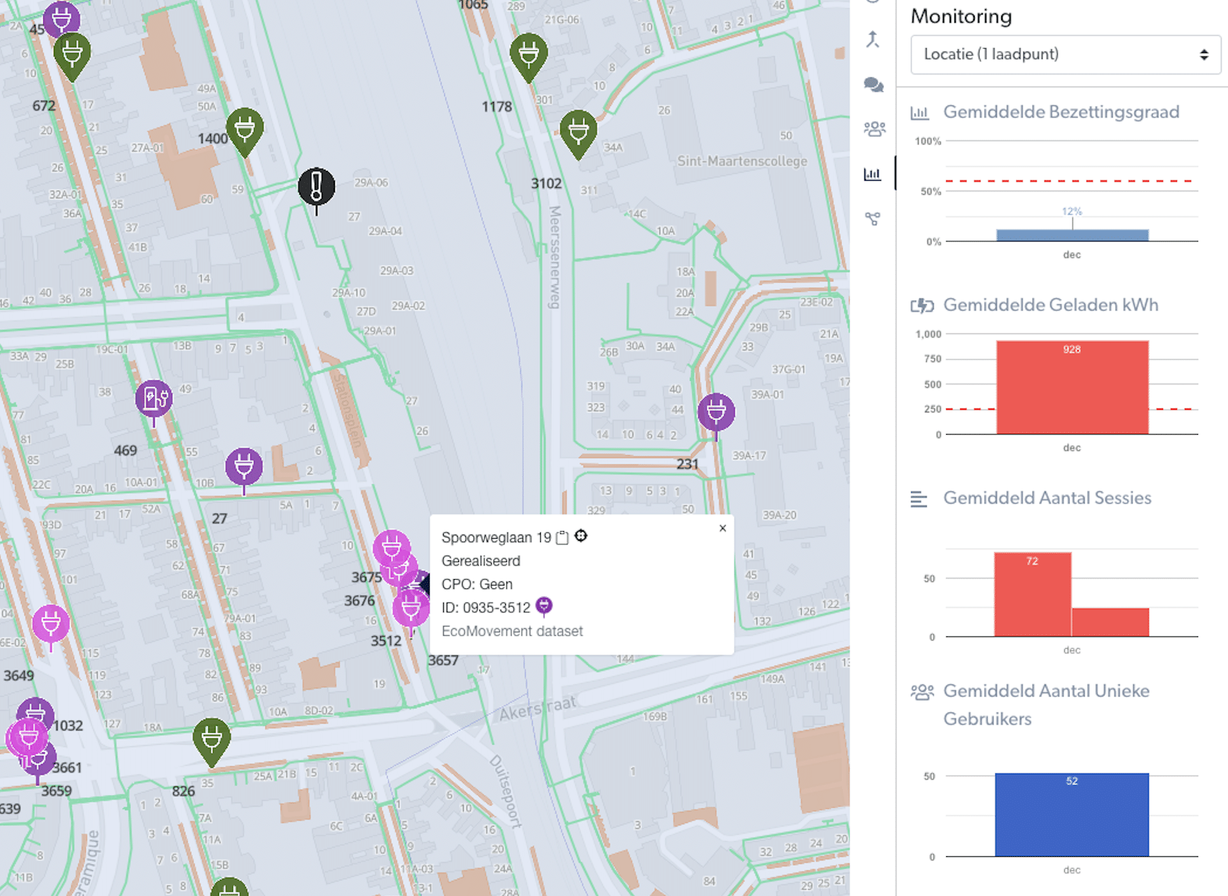
Usage data tells the real story. Easily discover where charging points are under pressure and add new charging locations precisely where they are most needed.
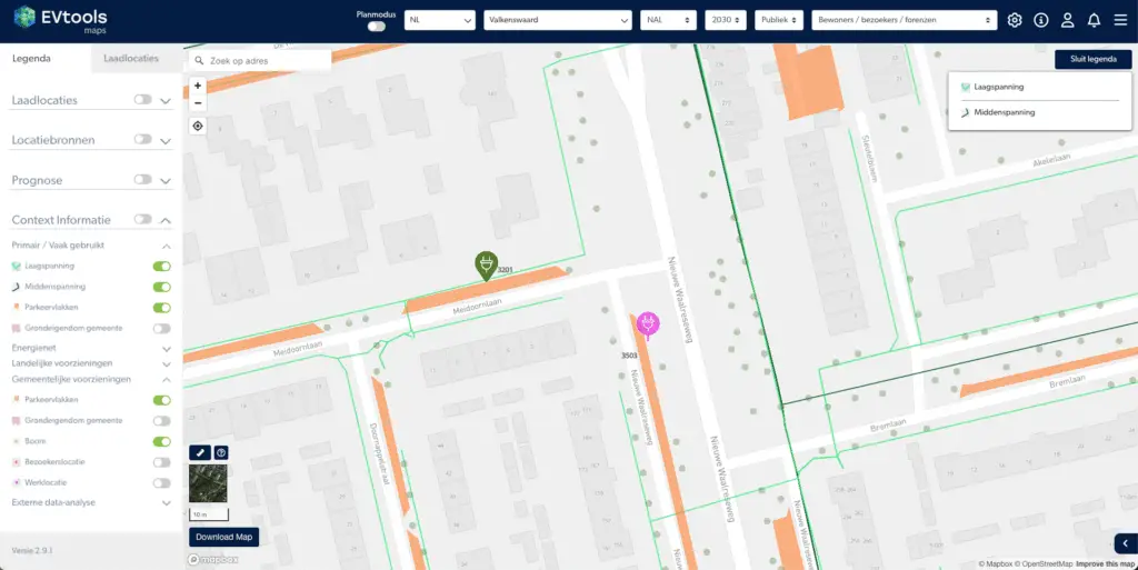
Utilize advanced map layers and real-time data to share a clear charging plan with residents, municipalities, and operators.
Engage residents through the participation portal,
accelerate the implementation process with the traffic decision module, or integrate systems via the GIS integration.
EVTools Maps is a data-driven mapping environment that allows governments, CPOs and real estate parties to analyze forecasts, charging needs and planning maps at the street, district and city levels. With Maps, users can make better decisions about charging locations, grid capacity and spatial planning.
EVTools calculates charging needs based on datasets such as CBS, RDW, Kadaster, grid operators, BGT and LISA. These data are combined with the SparkCity model (TU Eindhoven), allowing accurate forecasts per target group: residents, visitors and commuters.
The forecast map shows the projected growth of electric vehicles and charging needs by street or area. Users can compare scenarios, select target groups and visualize forecasts at up to 200-meter resolution, helping with strategic decision-making.
EVTools combines placement criteria, spatial data, user behavior and policy rules to automatically suggest suitable charging locations. These are displayed on the plan map, including priorities and scores per location for informed decision-making.
EVTools Maps is designed for municipalities, counties, regions, CPOs and real estate parties who want to plan, optimize and analyze charging infrastructure based on reliable data and predictive models.
Yes. EVTools Maps supports comparing multiple forecast scenarios, such as EV growth, policy variants or spatial developments. This allows organizations to create robust long-term plans based on data and policy.
With forecast and plan maps, EVTools Maps provides transparent justification for concessions, permit processes and tenders. Governments use it to objectively assess sites; CPOs and real estate parties use Maps for site selection and operation calculations.
Yes, all maps in EVTools Maps can be easily shared or exported for internal consultation, policy documents, GIS systems and external partners. This ensures that all parties involved are working with the same up-to-date data.