
Our service is designed to take all the hassle out of the process of choosing potential charging locations. Specifically, this means:
This allows you to remain in control while significantly speeding up the process.

The implementation process for drawing up the plan map has an average lead time of 10 to 14 weeks and consists of six clear phases.

Initial meeting in which we jointly determine the objectives and timeline.
Submit existing zoning map, geodata, and placement criteria.
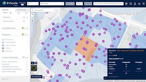
The number of locations to be selected is determined based on your specific requirements, current consumption data, and forecasts.
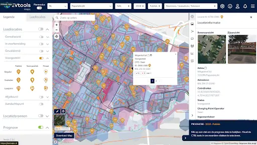
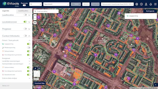
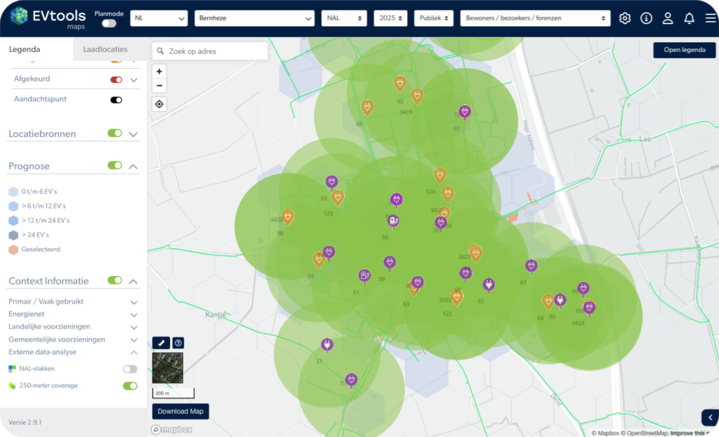
The charging locations are determined based on factors such as forecasts, current consumption data, and placement criteria, including top and side views.
A validation work session will follow, after which you will check the proposed locations.
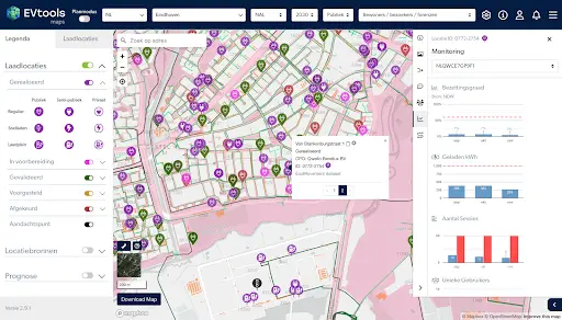
The final plan map is available in EVMaps and can be shared with your local operator.
A future-proof zoning map starts with up-to-date and reliable data. The more complete the data points, the better we can respond to local requirements and circumstances. We use the following, among other things:

Each region has its own preferences and requirements regarding location selection. To draw up/update the zoning map, we propose frequently used criteria, which can be supplemented/adjusted by the municipality as desired.
EVTools specializes in identifying future locations on a large scale based on criteria. However, we do not have specific contextual knowledge about situations in your region. It is therefore important that the final assessment of locations remains with the municipality, whereby we recommend that not only someone from the mobility department, but also colleagues from other departments within the public domain provide their feedback on the proposed locations, in order to realize a widely supported and feasible plan.


If you have any questions about maintaining the plan map or would like to share the plan map with an operator/regional government, please contact us.
The process support offers an updated plan map for 2030, complete peace of mind when it comes to data collection, and time savings of up to 80% in order to arrive at an internally validated load map.
The entire process has an average turnaround time of 10 to 14 weeks and is divided into six distinct phases, from inventory to final validation and completion.
EVTools uses the Large-Scale Topography Database (BGT), existing consumption data, future forecasts, data on the low-voltage grid, and local criteria such as parking spaces or tree maps.
The distance to the grid determines whether a charging station can be connected in a technically and financially feasible manner. If the distance is too great, the location is marked as unsuitable.
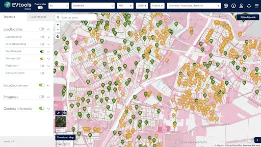
The statuses of locations are automatically updated in the plan map. EVTools recommends periodically maintaining the map so that decisions are always based on the most up-to-date data.
Once the plan map is ready, it can be shared with operators or regional authorities via EVMaps to start the structured implementation of charging stations.
The final assessment remains with the municipality. We recommend a broad validation process in which both the mobility department and other relevant departments within the public domain provide feedback.
Yes, each region has its own requirements. EVTools provides commonly used criteria that can be supplemented or modified by the municipality as desired to create a customized plan map.